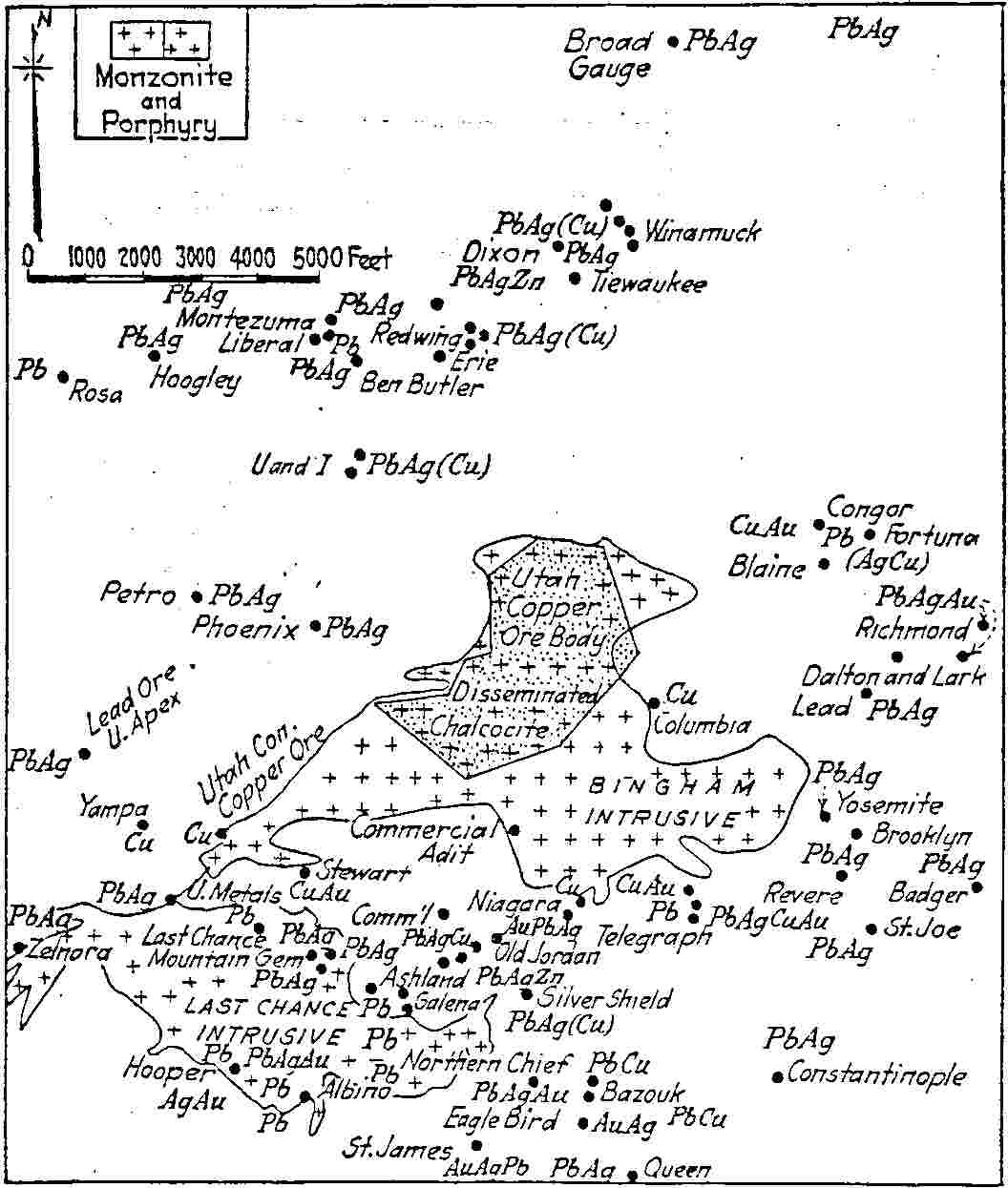
Before this map was published, the ore zones at Bingham were thought to be in belts extending through the Oquirrh Mountains. Richard N. Hunt proved that the orebodies in the mines at Bingham change in metals composition according to their distance from the central Utah Copper Orebody. The paper from which this figure was taken was published in 1926 in the Transactions of the American Institute of Mining Engineers, Vol. 74 p. 49.
Fig. 13.--Sketch of Bingham district, Utah, showing the deposits concentric with respect to the Bingham intrusive and eccentric with respect to the Last Chance intrusive. The series is:
1, copper ore in the Bingham stock (Utah Copper);
2, copper ore and lead ore near its contact--Ohio, Commercial, Telegraph, Niagara, Old Jordan, Brooklyn, etc.;
3, lead-silver ore farther away--Fortuna, Richmond, Galena, Queen, Last Chance, Utah Metals, Utah Apex, Tiewaukee, etc.
(Data from Boutwell, Hunt and Butler, and from company reports.)
To return to the Map Room, click here.
To return to the Hickman Index page, click here.