Where Was the Butcher Ranch?
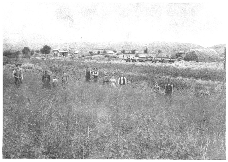
Several important clues are provided by the photograph shown below. First of all, it was south of the Bingham and Camp Floyd Railroad tracks (which later became the Denver & Rio Grande). And it was north of the Butcher ditch, which can be seen on the hillside in the background. And it was east of the major gully which can be seen above the haystack to the right. Now, if you have your 3D glasses (click here), proceed down this page and see if you can figure it out.
Caution:
Anaglyphic glasses should be worn beyond this point
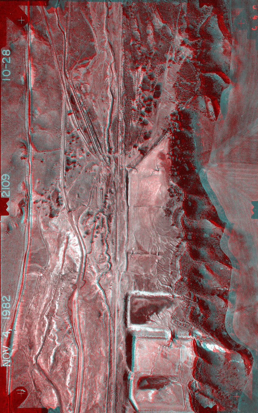
This is a 3D anaglyph of Bingham Creek with North to your left, and East at the top of the view. The abandoned Denver & Rio Grande Railroad right-of-way runs roughly up the center. The ruins of the Robbe precipitating plant (it operated from about 1935 to 1955) is a linear feature going diagonally toward the northeast corner of this view. The Utah-Apex tailing ponds (they operated between about 1917 and 1930) are in the lower right corner. The Butcher ditch can be seen running along the hillside above them. Environmental cleanups performed by Kennecott and Atlantic Richfield in the 1990s have rearranged the surfaces you see here, and the area is currently fenced off.
To obtain a pair of red/cyan 3D glasses to view this image, click here.
To see another anaglyph of Bingham Canyon, click here.
To see a map of this area, click here.
To see a September 2003 aerial photograph of this area, click here.
To learn more about the Butcher family, click here.
To learn more about Butcher properties at Bingham, click here.
To return to the Hickman Index page, click here.
. .